
So we were headed down for two more shows in San Diego for the SD International Fringe Festival on June 29th and July 1. So we had some extra time and decided to explore this beautiful little gem of a city, San Diego.
Again we chose to stay in the Gaslamp District of DTSD, and this time we found a very nice little hostel called Lucky D’s Hostel. Located on the fringe of the Gaslamp area at 615 8th Ave. between Market and G Streets, this hostel is also in a former hotel but unlike US Hostel just a few streets over this one was much larger and the facilities were much better. There was a large kitchen area, TV room, internet room, even a laundry and separate reading room area. We rented a private room with shared bathroom, and the room included a small refrigerator, TV, AC and a king size bed. While sharing a bathroom with others can worry some, the price difference and short walking distance to our theatre made the place perfect for our needs.

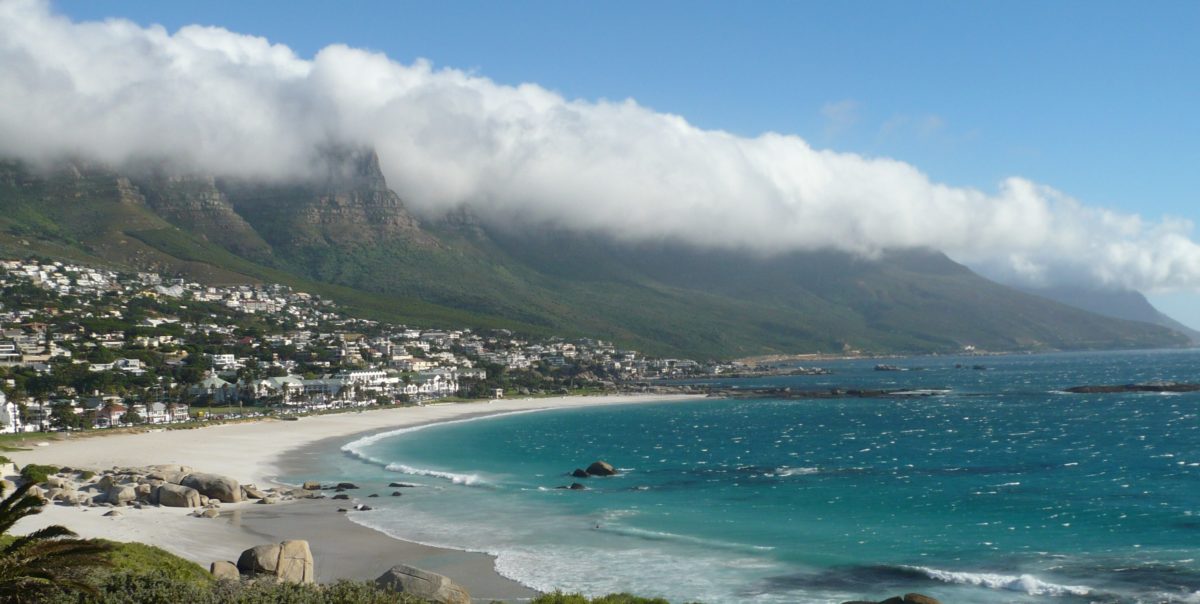
We had July 30th off so we drove out to Point Loma which is a hilly peninsula that marks the northern boundary of San Diego harbor. Going to Point Loma is #14 out 435 things to do in San Diego (Tripadvisor). It is historically important as the landing place of the first European expedition to come ashore in present-day California. The peninsula has been described as “where California began”. Today, Point Loma houses two major military bases, a national cemetery, a national monument, and a university, in addition to residential and commercial areas.

Point Loma is a separate community part of San Diego. The term “Point Loma” is used to describe both the neighborhood and the peninsula. After driving through the residential part of Point Loma, the first area of note that you come to is Fort Rosecrans National Cemetery. The Cemetery is a federal military cemetery in the city of San Diego. Row upon row of white military headstones placed against the beautiful background of San Diego harbor is both a powerful and sad reminder of all the sacrifices that young men have made for the US in times of war.

HISTORY
Point Loma was discovered by Europeans on September 28, 1542 when Portuguese navigator Juan Rodríguez Cabrillo (João Rodrigues Cabrilho in Portuguese) departed from Mexico and led an expedition for the Spanish crown to explore the west coast of what is now the United States. Cabrillo described San Diego Bay as “a very good enclosed port”. This was the first landing by a European in present-day California, so that Point Loma has been described as “where California began”. (Wikipedia)

The indigenous population of the area were known as the Kumeyaay people who did not live on Point Loma because there was no pure water source but periodically would visit to harvest mussels, clams, abalone and lobsters. (Wikipedia)

More than 200 years were to pass before a permanent European settlement was established in San Diego in 1769. Mission San Diego itself was in the San Diego River valley, but its port was a bayside beach in Point Loma called La Playa (Spanish for beach). The historic La Playa Trail, the oldest European trail on the West Coast, led from the Mission and Presidio to La Playa, where ships anchored and unloaded their cargoes via small boats. Part of the route became present-day Rosecrans Street. In his book Two Years Before the Mast, Richard Henry Dana, Jr. describes how sailors in the 1830s camped on the beach at La Playa, accumulated cattle hides for export, and hunted for wood and jackrabbits in the hills of Point Loma.[9] The beach at La Playa continued to serve as San Diego’s “port” until the establishment of New Town (current downtown) in the 1870s. (Wikipedia)
 The longtime association of San Diego with the U.S. military began in Point Loma. The southern portion of the Point Loma peninsula was set aside for military purposes as early as 1852. Over the next several decades the Army set up a series of coastal artillery batteries and named the area Fort Rosecrans. Significant U.S. Navy presence in San Diego began in 1901 with the establishment of the Navy Coaling Station in Point Loma.[12] During World War II the entire southern portion of the peninsula was closed to civilians and used for military purposes, including a battery of coast artillery. Following the war the area was consolidated into Naval Base Point Loma. Other portions of Fort Rosecrans became Fort Rosecrans National Cemetery and Cabrillo National Monument. (Wikipedia)
CABRILLO NATIONAL MONUMENT
After you pass through the cemetery area, you pass many Navy base sites until you come to the gate for Cabrillo National Monument. After paying the fee of $10 per car, enter and have the choice to go to the visitors center and the Old Lighthouse Museum or the Tidal pool area. We chose the Visitors center first.

The statue of Cabrillo is at the southern tip of the Point Loma Peninsula. It commemorates the landing of Juan Rodríguez Cabrillo at San Diego Bay on September 28, 1542. The whole site was designated as California Historical Landmark #56 in 1932. As with all historical units of the National Park Service, Cabrillo was listed on the National Register of Historic Places on October 15, 1966. The park offers sweeping views of San Diego’s harbor and skyline, and on clear days, a wide expanse of the Pacific Ocean, Tijuana, and Mexico’s Coronado Islands are also visible.

The Old Point Loma Lighthouse is the highest point in the park and has been a San Diego icon since 1855. The lighthouse was closed in 1891, and a new one opened at a lower elevation, because fog and low clouds often obscured the light at its location 129 meters (422 feet) above sea level. The old lighthouse is now a museum, and visitors may enter it and view some of the living areas.

The area encompassed by the national monument includes various former military installations, such as coastal artillery batteries, built to protect the harbor of San Diego from enemy warships. Many of these installations can be seen while walking around the area. A former army building hosts an exhibit that tells the story of military history at Point Loma.
TIDEPOOLS

Next came the tide pools area. You don’t have to walk this so do not worry. There is a drop of several hundred feet from the Lighthouse area to the tide pools and there is a beautiful little two lane road with dramatic views of its own that leads down to the tide pool parking area.

The southern end of Cabrillo is one of the best-protected and easily accessible rocky intertidal areas in southern California. The word “intertidal” refers to the unique ecosystem that lies between the high and low tides along the shore. Tide pools are depressions where water is trapped during low tides, forming small pools that provide habitat for numerous plants, invertebrates, and fish. These depressions are formed over geologic time through a combination of biological, physical, and chemical processes.

Cabrillo’s tide pools are an extremely popular destination for tourists, and it is estimated that more than 215,000 people visit the tide pools annually. Compared to sandy beaches, the diversity of life in the rocky intertidal is impressive. People go to the beach to swim, sunbathe, or surf, but they come to the tide pools to explore, experience, and learn. (Wikipedia)

Truly a very lovely day to Point Loma and Cabrillo National Monument. Well worth your time to see and experience the history of San Diego.
You must be logged in to post a comment.