Love Letter to Zim (Zimbabwe)


Zimbabwe beautiful landscape

Definition of Terms:
Zim – Nickname for the country of Zimbabwe.

Zimbo (s) – people born and raised in Zimbabwe. Currently living there or abroad are always Zimbos in their heart.

Eish – an all-purpose expression by Zimbos to signify amazement, frustration, excitement, or acceptance of something they cannot change.

Capital City, Harare

Last night in the capital city of Harare, Zimbabwe around 4 AM in the morning, the military forces of the country removed the 93-year-old dictator who had ruled for over 41 years and showed him the door. Bloodlessly, I might add so far. Presently, he is under house arrest in his 26-bedroom mansion awaiting his fate.

Zimababwe’s President Robert Mugabe in 2000 (AP Photo/Christine Nesbitt)

The dictator is Robert Mugabe, also known to his fellow Zimbos as “Uncle Bob”. For most Zimbos, that is not a term of endearment, but a name that symbolized that unwanted family member who is always there, stealing your food or DVD’s or extra cash from your wallet, never returning anything he borrowed, and constantly threatening your kids to behavior and respect him. In other words, the uncle who is a total jackass! Only difference with “Uncle Bob” is that he did all these things at gunpoint. Robert Mugabe was a ruthless, brutal man who was highly educated and very intelligent that managed through intimidation and murder to hang on to power for four decades.

CIty Centre, Harare

This morning Zimbos around the world woke up with a collective “Eish”, as people did not know what to think or whether to believe the news that they were hearing. Even at this moment on the ground in Zim, the news about what is going on is guarded and sketchy.

For those of you who do not know, Zimbabwe is located in the south-eastern part of Africa just above the country of South Africa. At one time it was one of the richest of all African countries, but after 40 years of “Uncle Bob” it is now one of the poorest with a broken economy, almost worthless money, and raging unemployment.

Driving into Mutare

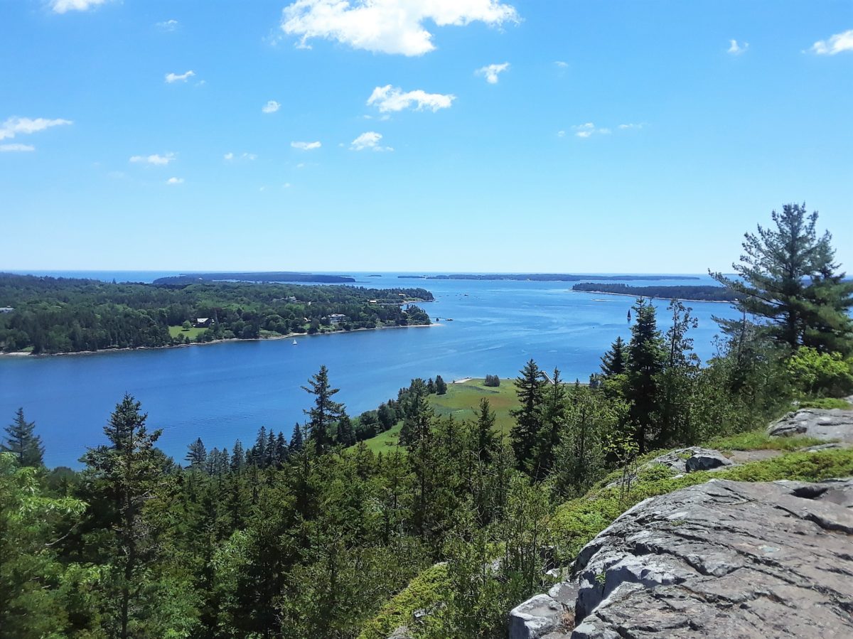
It is also one of the most beautiful, friendly, and hopeful places on the planet Earth. That is why I am writing this love letter to Zim and my fellow Zimbos. No, I was not raised there, but I have come to think of Zim as my second home. During 2012 to 2015, I lived and worked in Harare and all around Zim for a total of about 6 months. I traveled to all corners of the country and came to love its beautiful rivers, warm climate, lush forests, open savannahs with endless skies that make Montana’s Big Sky Country look small in comparison, dark evening skies filled with stars and its friendly, welcoming people.

I first went to Zim to work with a local arts NGO known as NIAA as a judge for their national drama festival. The next two years, I worked with them to develop an education program for rural teachers. The final year that I was there, I directed and co-produced a play for the country’s leading theatre organization, Reps Theatre in Harare. I also debuted a one-man show there and toured it around Zim and South Africa. My local Zim friends began to call me “an honorary Zimbo” for my obvious affection for their country and culture. Whether that was a joke or not, I took it as a serious compliment. So much so that I almost sold my home in Los Angeles and moved there full time to work as a theatre artist and teacher.

Workshop with Rural Drama Teachers

Why didn’t I move there if I love it so much? Well, I have to admit I am a product of my country, the USA. I like to be able to turn on a light and have it work every time. I like being able to drink the water from my tap. I like to be able to know that my money is worth something and it will always be that way. I like being able to openly complain about the idiot who is currently running my country without getting locked up. Zimbos could not do that. You always had to watch what you said in public and to whom. Eish!

Yet, every morning people all over Zim woke up not knowing if anything worked or what the government would take from them that day. Bob beat them down for 40 years, but what I remember was a people who were endlessly cheerful and hopeful. That is all they had to hang onto. Hope that one day it would get better. One day Uncle Bob would finally leave. And there would the opportunity to have things be better again. HOPE.

Zim’s iconic airport

But now after 40 years of turmoil and oppression and diminishing returns, he may be gone. Cannot say so yet, because Uncle Bob is a tricky guy with a lot of resources. Yet, there may be some hope for Zim yet. A chance to start over and realize the potential that these amazing people have and return their country to at least part of its former glory.

Zimbabwe is home of one of the oldest civilizations in sub-Saharan Africa. When the Portuguese found the Zimbos’ (known as the Shona) capital city (Great Zimbabwe) during the 1500’s, that city was already over 800 years old. There is a lot of history, a lot of pride and a lot of determination in Zim. Hopefully, they will get a government that they truly deserve, and it will allow them to flourish.

Kwe-Kwe main drag

As they say in Zim when things need to get done, “Let’s make a plan.” Hopefully, there are a lot of Zimbos making plans right now for a brighter future.

Romantic Rothenburg ob der Tauber – Germany

After 5 rainy days in Munich, I took the train out of Munich to Rothenburg to experience the community that has been on this site since 1150 AD. The official name of the city is Rothenburg ob de Tauber, or “Red Fort on the River Tauber.” Around 1160, Rothenburg was swiftly became a commercial center because of its’ enviable position on the age old trade routes through Germany where goods from the East passed through, but also because of “the white gold” known as salt.

700 year old cobble street

By 1400, the city was one of the largest and most successful cities in the area. The city had a population that topped 6000 people, and business was booming. Rothenburg was becoming very wealthy and was much worried about the safety of its’ wealth and citizenry. The city elders through the years constructed a sophisticated system of walls, towers, and gates for the protection of the city. Massive stone walls were constructed that were pierced with 7 main gateways and aided by 42 stone towers for defensive positions and protecting the town. Along the inside length of much of the city’s walls, covered walkways were built that allowed for archers and other solders to take up protected positions for watching or shooting at possible invaders.

Guards walkway on the outer wall

However during the early 1500’s and into the late 1600’s, the city began to experience a steady decline because of political and religious upheavals like the Peasants War, the Reformation, the counter-Reformation and the 30 Years War. Plus the “Black Plague” that were sweeping through Europe killing millions of people also visited Rothenburg and killed as many as one-third of the citizens. What remained by the 1800’s was a walled village that was once famous yet now was a backwater town with no real business and thus no real reason to change anything. It was if the once prosperous medieval village was trapped in a time warp. Narrow cobblestone streets, half-timbered houses with red tile roofs, massive stone walls that no longer protected anything but a poor half-empty village that recalled a more ancient time.

Massive stone walls and towers are part of the defense.

Yet along about 1850, fortune began to smile on Rothenburg once again. This time it was because of the very backward nature of the village that people were attracted. Because of its’ very medieval look and feel, artists, poets and writers discovered the old town and painted it, wrote about it, and talked about it. What was considered ancient and backward now became quaint. And as is true through the ages of man, when the artists and creative types come, soon the general public follow and you have tourism. Tourists helped make Rothenburg relevant again.

Chapel courtyard

They came for the quaint ancient walls and half-timber houses that were 500 years old. They came to see the old churches like St. James Church, the Gothic masterpiece with its hand carved altar. They came for the excellent Franconian wine, food and hospitality. They came for the chance to step back time and experience a little of what it must have been like in the Middle Ages.

One of the many gateways into the town

And that is what you get when you spend a day or two in Rothenburg – living history. Walls and houses and buildings that are in some cases over 700 years old, but people still use and live in them. A chance to walk cobblestone streets that have carried people and goods for over a thousand years. Walking the same covered walkways along the village walls that some guard walked 500 years before you.

You can actually walk the city by using the guards walkway

There is a suggested Town Walk around the village that will lead you through large squares where you will see historic buildings, along the city walls where you will find towers, churches, gateways and bridges that date from the 12th century and leads to other parts of the city where you may decide to wander off the “official” tour to see some mysterious door or walkway of Rothenburg that interests you. There are several museums in Rothenburg like the German Christmas Museum showing the history of Christmas through the centuries, the Imperial City Museum with its’ collection of items covering 9 centuries, and the gruesome and very interesting Medieval Crime and Punishment Museum featuring scary examples of torture and execution devices.

Center square

The most interesting thing to see in Rothenburg is actually live entertainment. It is the world-famous Night Watchman’s Tour which I will write about in my next blog, but it is without a doubt the best hour of entertainment in Rothenburg and at 8 Euros the best deal in Germany.

400 year old cover bridge (rebuilt of course)

The most romantic place in Rothenburg is the Castle Garden and Burgtor Gate. A huge quiet garden at one end of the town as you pass through the Burgtor Gate with spectacular views of the city and the surrounding valley. There is a small old chapel that has stood there since the 14th century and a lovely herb garden. The area is quite large with many old trees and benches to sit and read or just chill. If you walk further in the park past the chapel and herb garden to another viewpoint of the surrounding valley, rumor has it that this is the best place to grab a kiss with your significant other.

View of Rothenburg from the Castle Garden Park

And of course as a tourist destination, there are plenty of eateries of all types and places to sleep inside and outside the village walls. For something to eat, you have traditional German fare, non-German styles foods, Italian food (because it is just on the other side of the nearby Alps), sandwiches and snacks plus several Biergartens (beer gardens) all covering a range of prices and styles. But make sure that you eat early. Rothenburg shuts down early. In the Old Town there are no night spots, although a couple of places stay open till mid-night during the summer where locals mix with tourists.

My Hotel, PhinzHotel Rothenburg

If you are staying in the Old Town there are more than 20 hotels and hostels to chose from and in all different prices ranges from very expensive to a very reasonable hostel located in a former horse-powered mill house. Outside the walls, there are even more choices of food and hotels.

One of the Tower Gates into the City

Getting to Rothenburg is very easy. By car or bus, you are on the Romantic Road, a route that extends from Fussen in the south to Frankfurt in the north, and you pass right through Rothenburg. There several car parks in and around the Old Town, and cars are allowed to drive in parts of the Old Town. If you are coming by train, the station is literally a block away from the main gate of the Old Town.  You can only get to Rothenburg if you make a connection in Steinach. It is a little spur line with a small train that runs about every hour until 10:30 PM. If you arrived after 10:30 in Steinach, there is a subsidized taxi service that can take you to Rothenburg, but you must call them 2 hours ahead of time to make a reservation. To use them call AST at 09861/2000 in advance, and they will take you to Old Town for 4.60 Euros per person instead of the regular 31 Euro daytime charge.

Enjoy Rothenburg and step back in time for a romantic and fun adventure.


Last Day in Iceland

On my last full day in Reykjavik, I rented a car with my new Canadian friend, Andrew. He had not been to Thingvillier National Park yet, and I felt like I had not had enough time when I went there on the first bus tour that I took so that is where we headed first.

Photo Credit Andrew Guerra

Located about forty kilometers from Reykjavik, Thingvillier holds a very special place in Icelandic history. It is where they established the parliament or the Althing when the Vikings first arrived in the mid-900’s. They came to Iceland to escape a Norwegian chieftain who was uniting all the different factions in a bid to be the first king of Norway. It would work, he became Harald Fairhair. Plus they wanted more farmland they felt that Norway was overcrowded in 940 AD.

Interesting fact is that while Iceland (known as Islandia) had been known for hundreds of years. A Greek scholar referred to it in 4 BC, it was totally uninhabited when the Vikings arrived. They brought cows, sheep, horses, seeds, wives and slaves. The slaves were mostly from Ireland which the Vikings had been raiding for some time by the mid-900’s. As a matter of fact, the city of Dublin was first a Viking outpost. Rumors about that time has that the original city wall around Dublin built by the Vikings (called the Pale) was built not to keep Irish hordes out, but to keep Viking men inside because they desired Irish women so much. This is also rumored to be where the term “beyond the Pale” comes from. When the men left and did not come back, they had gone “beyond the Pale”. I do no have factual back up for this theory as it is just an age old rumor in Dublin, but current DNA studies done by the Icelandic government have proved while 80% of the original men that came to the island were Viking and 20% were Irish (most likely slaves), the original women who came were 60% Irish and 40% Viking. Most of those women were wives and not slaves. Thus the island while claiming to be Viking the actual original population was 60% Viking and 40% Irish.

Iceland was the only part of Europe that was not directly ruled by a King so a ruling council was set up that met once a year at Thingvillier for two weeks or more that made laws and rulings on how the land would be ruled. The council was only run by the ruling chieftains, but in it way it was the first democracy in Europe since Athens in Greece in 500 BC.

Chieftains decided on a “law giver” or a judge whose word was final. The Law Giver had to learn by heart all the rules and laws of the new land in order to offer fair judgement. So for the first three days of each Althing every year, the Law Giver would recite in public all the laws. It could take him up to three days to do this, and after this the trials and meetings of the council would begin.

Thingvillier was where this took place, but it was also a social and economic gathering as well. Merchants, traders, and slavers would all bring their offerings to buy and trade. In some cases, people would travel for up to two weeks in order to attend this gathering.

Executions and judgements were also handed down and performed at this annual meeting of the island’s people. The executions could be anything from hanging from the rocks, or drowning in one of the ice-cold lakes, or beheading. All in public view, so people saw the laws and punishment carried out.  And the gathering or Althing would go meeting for several hundred years in one form or another.

The current Thingvillier is a park where people come from all over the world to see another very important gathering that takes place every day. This is the only place above ground where the North American and European tectonic plates can be seen. The plates are currently moving away from each other at a rate of 4 meters a year making Thingvillier an ever-changing place of incredible rock formations and water falls and lakes and streams. The water is crystal clear here as it runs off the nearby glacier Langjokull and you can go diving (only in a wet suit because the water is so cold) and actually go inside the rift between the plates.

Andrew Guerra leaving 1st Icelandic Church

Thingvillier is also where it was decided by the Law Giver to move from Paganism to Christianity. This was done in 1000 AD at the Althing. Both sides presented their cases to why one religion should lead to the Law Giver, and he decided which one would be the official choice of the people. Christianity won, but the decision was very wise. You would be Christian in public and by law, but if you wished to continue to be Pagan and worship the Norse Gods of Odin and Thor and Loki in private that was totally accepted. This way Iceland avoided the bloodshed that most of Europe was swept up in during this long epic transition.

Prime Minister Summer Residence

For that reason, the first church built in Iceland was constructed here in 1000 AD, and the church is still standing. It has been rebuilt and moved around the park because of the tectonic plate shifts, but the symbol is very strong. And the history and place of Thingvillier in the minds of Icelanders is so strong that the ceremonial summer home of the Prime Minister is also located here. IT is only used for official occasions and ceremonies, but this place seems to be the symbolic center of the country.

Kerio Volcanic Crater

After an hour, we went to see a nearby volcanic crater, Kerio which was created about 6500 years ago, but now looks like a giant swimming pool (but really, really deep one).

James Carey at Kerio

Then we had a very expensive lunch (no surprise) of lamb soup and pizza (surprisingly excellent) at a small hotel restaurant outside of Silfoss . Then we drove along the southern coast back toward Reykjavik through an ancient lava debris field that looked like you on some other world. Movies like Ridley Scott’s movie, Prometheus, and Thor, Dark World and Game of Thrones have used the strange magical environment of Iceland to create their other worlds. It was a very pleasant last day in Iceland and we had beautiful sunshine until the drive back when rain and dark clouds made the lava field even more ghostly.

Note is you are renting a car here in Iceland like everything else here it is expensive, but there are plenty of firms to choose from. Gas or petrol at the moment costs almost 7 dollars US a gallon. However, here they use liters and not gallons.

Enjoy Iceland if you get a chance.


Whitewater Rafting in Kernville

So after the day at Buck Owens’ Crystal Palace, we woke up early and drove the 40+ miles to Kernville through some really beautiful country on California 178. At the town of Lake Isabelle, you turn on to California 155 that takes you up to Kernville.

The Kern River is a river in the state of California, approximately 165 miles (270 km) long. It drains an area of the southern Sierra Nevada mountains northeast of Bakersfield. Fed by snow melt near Mount Whitney, the river passes through scenic canyons in the mountains and is a popular destination for whitewater rafting and kayaking. It is the only major river in the Sierra Nevada mountain range that drains in a southerly direction. Nearly all of the river is publicly accessible. Its swift flow at low elevation makes the river below the reservoir an extremely popular location for rafting.

photo0jpg

The Kern is well-known for its danger, and is sometimes referred to as the “Killer Kern”. A sign at the mouth of Kern Canyon warns visitors: “Danger. Stay Out. Stay Alive” and tallies the deaths since 1968; as of June 9, 2012 the count was 266. Merle Haggard’s song “Kern River” fictionally recounts such a tragedy. Most of the people who died in the Kern River were recreational users who entered the water without proper life vests. Less than 2% of the deaths in the Kern River have occurred during commercial raft trips. (Wikipedia)

IMG-20160703-WA0006


Kernville itself, is a very small town on the Kern River of only about 1300+ people. For its size, Kernville has a large tourist industry focused on the white water rapids of the Kern River. While white water rafting is the main attraction, one can also enjoy mountain biking,rock climbing, and other outdoor activities. Fly fishing is also popular; in particular, the golden trout is highly sought after for catch and release fishing. Downtown Kernville which consists of a large tree-shaded square and buildings on three sides with highway 155 on the 4 side, has an Old West look and contains a number of restaurants, antique shops, bars and motels.

20160702_122005

We had taken advantage of a Groupon special for the last weekends of rafting with a company called SoCal Rafting. TripAdvisor gives them a 4.5 rating out of 5.

IMG-20160703-WA0005


socal-rafting


It was 4th of July weekend so it was extremely busy with people literally everywhere waiting for their tour or buying items for the float. The first step after checking in was getting fitted for a life jacket which they clinch up extra tight and getting your paddle.

IMG-20160703-WA0004


Then there was a short safety speech about how to act on the water and such. Then on to the bus to take us to the drop in spot on the river.

IMG-20160703-WA0008


While on the bus, a longer safety speech with a few tales of tragedies and mishaps on the river along with the creation of buddy teams to help watch out of each other. Also a demonstration on to float the rapids in case you fall out of the raft.

Then we were on the river in rafts of different size some holding up to 8 people and some holding just 4, all with a guide to steer the raft. Both sides of the river have beautiful homes and open areas that the locals use as their beaches. And all the way down the river, locals on both sides are splashing you with water as you pass by. So you are part of this running water battle all the way down the river with Class 2 and 3 rapids in between.

13557656_966636893449840_2980426879175209118_n

This was a lot of fun. Yet, there were some very scary moments as you went over the rapids backwards or sideways with the possibility of always falling out in the rushing water. That is not the danger – falling into the river. The danger comes from the extremely fast current and you hitting one or more of the huge rocks that could knock you out or hurt you badly. Or getting your foot caught in the rocks and breaking an ankle or drowning. Twice we had people in the front of the raft fall out and our guide was quick to respond by getting the people back into the raft swiftly.

The guides for Socal Rafting were total pros. They were knowledgeable and fun with interesting tales about the history of the area and the river. I would recommend this again. We did the short one hour run, but there were longer two-hour and four-hour tours, plus all day floats.

Because of the California drought now in its 5 straight year, the river has been down and the season for rafting is shorter each year. Please check before you go to make sure that the river is open for rafting.

20160702_122021


After getting off the river, we were hungry and the only non-bar on the square in Kernville was Big Blue Bear. Combo gift shop and eatery, the counter person was a little intense but we got our food and it was good. It seems the main place for locals to gather so a real combo of tourists and locals. Worth checking out.

Great trip within 5 hours of LA and worth the time for something different.