Escaping LA and the Salton Sea

Leaving California

“It’s a dangerous business, Frodo, going out of your door. You step into the Road, and if you don’t keep your feet, there is no knowing where you might be swept off too.” J.R.R.Tolkien, The Lord of the Rings.

It was 3:15 AM on March 16th and the Road was calling. I was wide awake staring at the ceiling. I had been trying to go back to sleep for the past 45 minutes and it just wasn’t going to happen. What I didn’t know was the strange last-day-in-California adventure that awaited me over the next 24 hours that would include casinos, a salt water lake, an apocalyptic ruin, an Alaskan in the middle of the desert, and a stripper/dance contest in Yuma, AZ. How did the Road sweep me away on this adventure?  Well, that’s where this story begins!

The Hacienda. My home for 20 years!

My house was empty! The place I had called home for 20 years was now completely empty.

Everything is gone except these things!

Every stick of furniture, every piece of paper, every knickknack, tchotchkech, and geegaw that I had ever possessed was gone! Over the past week I had sponsored an estate sale and then a truck from a local charity had come by and picked up the last possessions that I had not wanted to keep. For weeks before that I had been packing and sorting and throwing out massive amounts of junk. Then out of a large 17 room house, I only had two small U-Haul pods of possessions left that I had personally loaded and sent on their way towards Atlanta. The only thing that was still left in the house was the long-time caretaker of the property that had allowed me to travel the world as much as I had and who also happened to be my roommate, Kirk. He would be staying in the house for about another month until it sold and then he would be off on his own new adventure. I had said goodbye to Kirk and then booked a room in a Koreatown hotel. After checking in, I had gotten a takeout pizza and two large cans of beer which I had in my hotel room while watching some terrible movie on TV. About 10:30 I realized that I was emotionally exhausted and just crashed only to find myself waking up at 2:30 AM. For the next 45 minutes as I struggled to go back to sleep, my mind kept going “It’s time to go. James, it’s time to go! The Road is calling! Let’s go!” 

The Road Calls!

So finally giving in, I got up, took a quick shower and got packed. I was checked out and had the car loaded by 3:45 AM. Before I left Los Angeles perhaps for the last time, I drove by my place one last time. My house, my home, my Hacienda that had been the center of my life for the last 20 years. As I sat in the car and looked at her there in the moonlight, I said one silent last goodbye. I was off on a new life adventure, and she was waiting for the next family that would call her home. I said a silent prayer for both of us, started the car and drove the two blocks to Interstate 10. I merged into the late-night traffic and headed east out of the City of Angels.

For days before leaving, I had tried to think of which highways I wanted to head East on. My sister had urged me to take my time driving across the country and see all the things that I wanted to see. Yet, I had made this trip four times in the last year and a half, and I had stopped every place that I had wanted to stop and had seen everything that I needed to see. So that morning as I drove out of LA, I had no clear plan as to where I was going to go or what my timeline getting to Atlanta was going to be. So I just decide on Palm Springs. I didn’t know if I was going stop in Palm Springs, chill out at Desert Hot Springs or just keep on moving, but Palm Springs was going to be my first stop.  Palm Springs is about 90 miles from Los Angeles and that 90 miles even on 8 lane freeways usually takes at least two and half hours because of the California traffic. Yet at four in the morning there is little to no traffic, so I pulled into the parking lot at the large Morongo Casino on the outskirts of Palm Springs about 5:30 AM.

Morongo Casino, Resort & Spa is an Native American gaming casino, of the Morongo Band of Cahuilla Mission Indians. The Morongo Casino was opened in 2004. It is open seven days a week, 24 hours a day. The hotel has 310 rooms, and several restaurants and bars are part of the complex. I was already vaccinated so I went inside to find breakfast. The 24-hour restaurant was closed because of Covid and reduced hours, so I got a muffin and coffee at the bakery. Then wandered around and played video poker with the help of a Bloody Mary until 7 AM when the Road called again urging me on.

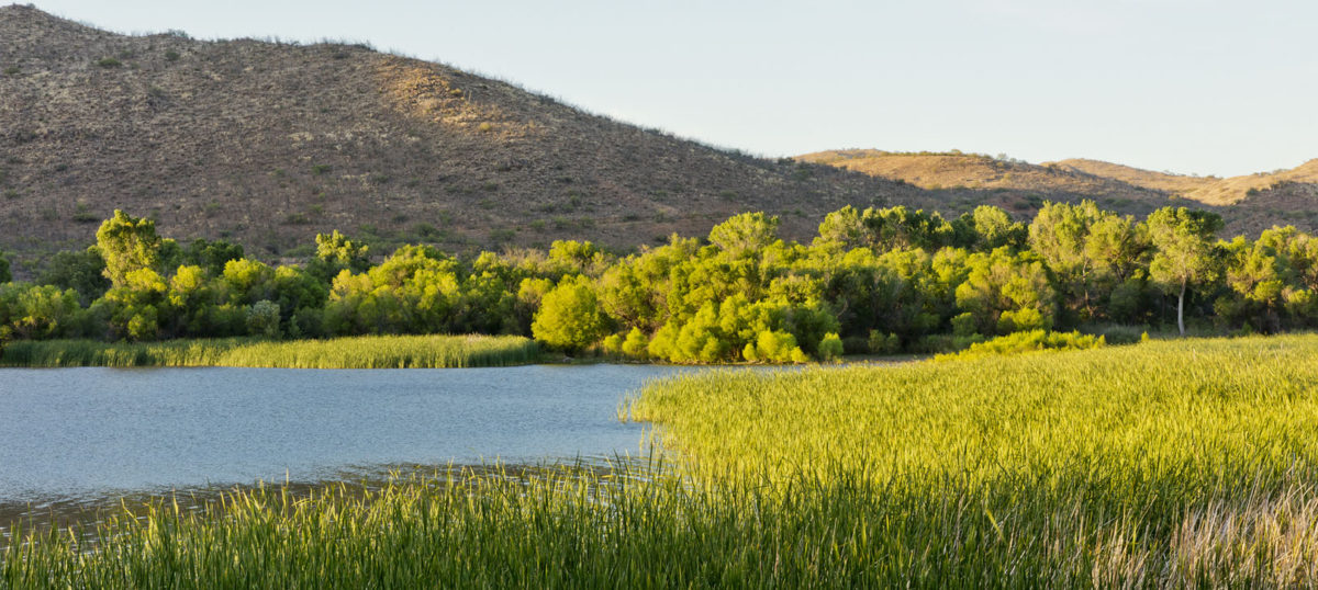
It is at that moment that I decided to drive the 60 miles to the Salton Sea and check it out. I had lived in Southern California for almost 40 years and never even thought much about seeing it and it was now or never. I headed east on I-10 toward Indio and got off on California 86 South and drove pass Coachella, the home of the famous music festival, and continued on toward the Salton Sea. You reach a point where you can take either the eastern shore on Highway 111 or the western shore on Highway 86. I choose the eastern shore which would lead me toward an artist colony I had heard of called Bombay Beach.

The Salton Sea is a shallow, landlocked body of water that has a high concentration of salts. It was created by water runoff from the Colorado River in 1905 when an irrigation canal head gate was broken through by spring floods diverting a portion of the river flow into the Salton Basin for two years before repairs were completed. The water in the formerly dry lake bed created the modern lake that is about 15 by 35 miles. The lake would have dried up, but farmers used generous amounts of Colorado River water and let the excess flow into the lake. In the 1950s and into the ’60s, the area became a resort destination, and communities grew with hotels and vacation homes. However, by the 1970’s, the lake had begun to shrink and become more inhospitable to people and wildlife. In the 1980s, contamination from farm runoff promoted the outbreak and spread of diseases. Massive die-offs of the avian populations occurred, especially after the loss of several species of fish on which they depend. Salinity rose so high that large fish kills occurred, often blighting the beaches of the sea with their carcasses. Tourism was drastically reduced. During the 1990’s, the lake continued to shrink and the lake bed became exposed, the winds sent clouds of toxic dust into nearby communities making people sick and driving away what was left of the tourist communities. The Salton Sea has been called “the greatest environmental disaster in California”.

Advertising a place that no longer exists!

As I drove South on Hwy 111, I started to pass nurseries that grew palm trees but after a few miles even that sign of activity ended. You came into open arid desert with panoramic views of the lake on your right and nothing but endless desert on your left. I drove by what at one time had been communities, but now all the buildings were either boarded up or in disrepair. I drove by one community where people still lived, and I pulled off the highway to see what I could see. Most everybody in the community was older and at a local Community Center they were handing out food and supplies to the residents possibly because of COVID. What you soon began to understand is this is one of the last places that people with little or no resources can come to and stay in California. They could buy a cheap piece of property, or they might be able to find a room, small apartment or trailer for not much money, but there was just a sense of poverty and loneliness as I got back on Hwy 111.

The US Department of Interior has taken over much of the eastern shore of the lake and turned it into a preserve trying to maintain the wildlife and keep the lake from further eroding. There are many areas where the river has retreated so far from the lake that you can almost not see it from the highway, and these areas unless you have a pass or are willing to pay the daily entrance fee is the only way that you can get close to the lake. Finally I came to Bombay Beach which I had heard about on a television show which they had described as a colony of artists who were banding together on the edge of the Salton Sea. I turned off the highway into Bombay Beach and for the first few blocks as I headed towards the lake it seemed like it was doing well. There were a few art galleries, a restaurant, a couple of bars and a grocery store. Yet, as you drove the last few blocks toward the lake it suddenly became a cross between The Walking Dead and Mad Max. You had the feeling that you were in an apocalyptic ghost town and zombies were going to start walking down the road at any moment to eat you. For blocks, yard after yard of burned out houses and trailers were surrounded by junked furniture and trash. Every once in a while, you would see someone who had a small house or trailer who was trying to take care of their property but they were surrounded by chaos and garbage and ruin. It looked like a whole army of crystal meth heads had ransacked the town looking for anything that they could sell and moved on. The few people that I saw driving on the street or walking were all above 50 and they seemed old and beaten down. I drove out of Bombay Beach with a feeling of sadness at what looked like a desperate situation.

Desperation this way!

Continuing south on Hwy 111, it ultimately dumps out on Interstate 8 that runs between San Diego and Phoenix along the US southern border with Mexico. I turned left and headed east towards Yuma, AZ. A few years ago was the first time I’d ever gone to Yuma, and I have now been back five times. There’s something about this desert community and its colorful history mixed with it easy paced lifestyle that just appeals to me, although the extreme summer heat can makes it very inhospitable. As I drove east, I decide to stop one more time in Yuma before I headed towards Atlanta.

Yuma is located on the southwestern edge of the state of Arizona near the borders of California and Mexico. It is home to a number of snowbirds in the winter and other visitors are often enroute to Los Algodones, Mexico for cheap medical services or for the shopping. Yuma has been a stopping point for centuries. Before dams were constructed up and down the Colorado River, the river ran fast and deep and stretched wide in places, yet because of granite outcroppings the river was squeezed into a narrower channel and Yuma Crossing became known as the safest and easiest place to cross the river. The first Spanish conquistadors who helped settle Los Angeles and San Francisco did not sail up the California coast to settle those areas, they used Yuma Crossing on their way towards California.

Gowan Headquarters in the former US Post Office Building.

I pulled into town and checked into one of several hotels located in Yuma. There are all levels of hotels here from cheap to very luxurious because of the flow of Americans who cross into Los Algodones for easy to obtain medical treatment and prescriptions. I choose one relatively near the historic downtown area of Yuma. It was about noon and the weather was in the mid-80s in March as I headed downtown to get something to eat. Arizona had fairly open Covid laws so as I walked around, I saw people wearing masks and some people not. After lunch, I walked around the historic downtown area and saw many of their restored historic buildings. Some dating from the late 1890s all the way up until the 1960s. Yuma is one of the wealthiest farming communities in the United States specializing in growing winter vegetables for the US market. The Gowan Company is a family-owned agricultural business that started in Yuma and grew into a global leader in seeds and agricultural solutions. They have bought up many of the historic buildings and preserved them using them for office and storage space including many mid-century architectural gems.

Former JCPenney’s store from the 1950’s!

My odd schedule finally caught up with me and I went back to the hotel for a nap. Later, around 8 PM, I ventured out for dinner in the same downtown area. Afterward, I took another walk and ended up at the Red Bird Cage, one of the oldest saloons in Yuma, a real dive bar with friendly bartenders and a great juke box. It was a little close in there with a very casual mask and social distancing policy, but I managed to find a quiet corner of the bar to seat by myself.  As the bar began to fill up, a young couple sat down next to me, and we started talking. They were cousins and both really attractive people. Turns out he was an exotic dancer working in the Phoenix area mostly, and she (who I will call Ann) lived in Alaska working at the canneries up there about half the year. The other months, she returned home to Yuma to work in a family business, but she now really preferred Alaska. She told me that she almost did not return to Yuma this year because she just loved Alaska so much.

Colorado River

After talking for about an hour, some of their friends showed and things got a little rowdier. After a couple of rounds of drinks, they started talking about going to the strip club for the “dance off”. I asked what that was, and it turned out that there was some kind of dancing/stripping contest at the local club to see who had the best routine. Ann seemed to be in lust with one of the strippers and wanted to go support her. The whole gang got up to leave for the club, and Ann invited me along. With nothing better to do, I tagged along. Now going to a strip bar in the middle of pandemic is a very interesting undertaking with everyone wearing masks inside including the strippers as they walked around trying to get men to buy drinks. It was very strange to see a woman wearing almost nothing sit at a table chatting up a potential customer with a mask on. The image was just too weird for words.

The “dance off” began and Ann’s favorite came on second. Ann enthusiastically cheered her on while throwing dollar bills on the stage. By now it was about 1 AM and this time the Road was not calling, it was my Bed. So I said good night and drove back to the hotel. Yet as I got ready for bed, I reflected back on the past 24 hours and marveled at all the different things that happened. My leaving LA in the middle of the night, the casino, the desolation of Salton Sea and Bombay Beach, then driving to Yuma, meeting a woman in a desert bar who worked in Alaska and the strip/dance off contest. All in all, an extremely interesting way to leave California.  

Thanks for coming!

*Special thanks to Wikipedia for historic information on Salton Sea, Morongo Tribe, and Yuma, AZ. All photos by James Carey except The Open Road @ Popular Science/popsci.com and Leaving LA @KCRW LA.

**Quote from The Fellowship of the Ring, JRR Tolkien, Houghton Mifflin, Inc., 1938.

Three Days at Zion National Park – Day 1

Wonders of Utah

I’ve lived in California for over 30 years and I have been to Las Vegas at least 25 times, yet I had no idea that Zion National Park was only 2 1/2 hours away from Vegas in south-western Utah. So it was with great excitement that I decided to travel to Zion National Park when my wanderlust had become overwhelming.

View inside the park

First, I stopped off in Las Vegas for an evening before driving all the way to Zion which turned into two days when I woke up the next morning with a bad case of food poisoning that of course made me think I was suffering from COVID-19. After spending the entire day in my room recovering, I woke up on the third day hungry and refreshed. Two and half hours later, as I drove across the desert out of Nevada and across the northwestern corner of Arizona, I entered Utah. I had not been in the state of Utah for 25 years, and I had forgotten how incredibly beautiful it is.

View from Springdale

Turning off on Utah State Highway 9, I wandered through the towns of St. George and Hurricane and La Verkin and Virgin until I reached the gateway to Zion National Park which is Springdale, UT. I had started looking for a hotel to stay starting at La Verkin, and the prices increased exponentially the closer I got to the entrance to the park. I finally settled on a slightly rundown but comfortable hotel in La Verkin about 17 miles from Zion called the Hotel Zion Inn. The hotel had seen some hard times but had recently been taken over by an Indian family who was rebuilding it slowly. The hotel was a huge complex with four separate buildings but at the moment they only had about 50 rooms available. The beds were comfortable, the air conditioning was great, they had wonderful cable television and the hotel was clean if not a little dated. And the price was perfect if you weren’t looking for luxury at $34 a night. The price including tax was $117.00 off Hotels.com.

Hotel Zion Inn, 150 N State St, La Verkin, UT 84745, Phone(435) 635-0965

Theories about the origin of La Verkin’s name suggest that it may be a corruption of the Spanish la virgen, after the nearby Virgin River, or possibly an error in the transcription of the term “beaver skin.”

Oldest store in Virgin, UT

The next morning after a simple breakfast at the hotel I drove the 17 miles to Zion. Along the way I passed through the very small-town Virgin, Utah. The first settlement at Virgin was in 1858. It’s also the name of the river that carved out the canyon that creates Zion National Park.

Very interesting rock on the Watchman Trail.

Arriving in Springdale you immediately become aware the town is set up completely to service the tourists that visit Zion National Park on a daily basis. The elevation is 3800 plus feet and the average hotel price in the town is around $230. There are several restaurants, bars and art galleries and other things to do both family related or otherwise in the town so there is a bit of a nightlife there.

Views on the Watchman Trail

Parking is quite easy in Springdale because there is a free shuttle that runs from the edge of town all the way up to the opening of Zion National Park. However there are a few peculiarities about the parking situation. Everything is based on a credit card and there are three choices. Parking is a dollar an hour in all areas and you can choose one hour, two hours or twelve hours and nothing in between. Those are the only choices. There is parking inside Zion but there is no driving in Zion. Everything is either by shuttle or hiking or by bicycle.

Vista from the end of the Watchman Trail

There is a shuttle inside the park which is a one dollar ticket, but you must (https://www.nps.gov/zion/planyourvisit/zion-canyon-shuttle-tickets.htm) buy the ticket online the day before and have verification either with a paper print out or on your phone or iPad when you show up at the park. For those people who did not know how to get a ticket they start handing out free shuttle tickets on the day of on a first come first serve basis at 3:00 PM in the afternoon. The shuttle will take you deep into the park to Riverside Trail, the Emerald pools both lower an upper and to other trails. It is not recommended to hike to those places because some of them are literally 10 miles in one direction. So unless you’re going to stick around the entrance of the park the only way to see those other sites is either by renting a bicycle or taking the shuttle.

The Watchman

Around the entrance of Zion National Park are two trails one is the Watchman trail and the Pa’rus trail. Both are 3.5 miles round trip, but the Watchmen is a grade two trail that goes up the face of the Watchmen a singular tower of stone that kind of feels like the sentinel or guard for the park hence the name the Watchman.

On the Watchman Trail

Starting in between the Visitor Center and the South Campground, the Watchman Trail heads up to a viewpoint on top of the first layer of cliffs roughly 300 feet above the canyon floor. While the trail doesn’t actually take you to the top of the Watchman, you can still get a good view of the famous and photogenic peak to the south as well as a good bird’s eye view of the canyon and Springdale below. The trail is mostly family-friendly but keep a close eye on children as there are a few cliff edges to pay attention to. This trail is completely exposed to the sun, so during the hot summer months, this hike is best done on a cloudy day or in the morning when this side of the main canyon is still in the shade. The trail is not paved and there are lots of rocks and strenuous areas to get through. The view is worth the hike.

More of the Watchman Trail

Part 2 of this three days In Zion National Park will focus on the Pa’rus Trail and trying to get to the Emerald Pools and the Riverside trail.

Part 3 will focus on the Kolob Reservoir on the backside of Zion National Park where there are really great trails away from the crowds and the commercialism at the entrance to the park.


Daily Photo – June 12, 2020

Antelope Canyon, Arizona
Photo credit – https://www.cntraveler.com/galleries/2015-11-27/the-50-most-beautiful-places-in-the-world

Drive Across America – Day 5 – 7, Abilene to Atlanta

One of my grand plans before I left to drive across the country was to stop everyday to see something interesting, take a hike, or visit some place I haven’t been before – but after driving four days non-stop across the United States (of course only 300 miles a day) I was anxious to get to my final destination, Atlanta. So Days 5 and 6, I really didn’t stop, I just drove.

Abilene, Texas was a nice town. The night I arrived I wanted to get some something to eat in a nice restaurant and I found a nice place using Yelp. The bartender recommended a pub near the local college to check out, and I ended up in a few games of friendly pool with some locals who were very nice. Abilene is actually considered a very good place to visit and live – this link will tell you a lot about Abilene history and livability – https://livability.com/tx/abilene . But overall Abilene did not leave much of an impression on me. I was only there for a night and my apologies to anyone who reads this who is from Abilene but I just decided to move on down the road.

Cisco, TX Photo J.Carey

But as I was headed east on Interstate 20 I did come to an interesting little town called Cisco, TX. Cisco seems to be surrounded by a lot of trees which was different after 4 days of driving across desert and flatland. That was because of Lake Cisco, a man-made lake created in the 1920’s.

Conrad,Hilton Photo J.Carey

One of Cisco’s claims to fame is that Conrad Hilton, the founder of the Hilton Hotel chain bought and operated his first hotel in Cisco. The story goes that Hilton came to Cisco to buy a bank, but the bank cost too much, so he purchased the Mobley Hotel in 1919. The hotel is now a local museum and community center. The hotel had about 40 rooms and did a very brisk business right from the start as this occurred during the beginning of the Texas oil boom. It’s now on the National Historic Register, and right next to the community center is a little park called the Conrad Hilton Park with a small statue of him there.

Photo J.Carey

The rest of the drive that day is kind of a blur as to what happened because the entire focus of the trip was now just trying to get out of Texas and across as much of Louisiana as I could make in my 300 mile radius. I spent the night in Greenwood, Louisiana.

One last comment about Texas before I move on. What is it in Texas with the super high transition ramps to other freeways? They’re in every city no matter how small or how large, and they just keep going higher and higher and higher. Other states have them as well but Texas seems to have a real proclivity for building these structures. As I drove across the country along the southern route, Texas by far had more of them than any other place I’ve ever seen. Fort Worth has so many freeways crossing and re-crossing each other that the confusion of roads and bridges and transition roads is called the “Mixmaster.”

The Mixmaster, Fort Worth

Day 6 was just spent driving I-20 through Shreveport, Louisiana on to the Mississippi River. I crossed the river at Vicksburg, MS. This is the site of a huge battle during the Civil War between the North and the South. The North had been trying to take Vicksburg, a major port city for the Confederates on the Mississippi for months. Every time they were rebuffed by the Southern soldiers. Finally Lincoln placed a relatively unknown general in charge of the effort, U.S. Grant. Grant laid siege to the city for 45 days cutting off all food and water. The Southern command finally surrendered, and the victory turned Grant into a Northern national hero.

Entrance to Vicksburg Military Park Photo J.Carey

The Vicksburg National Military Park is here that you can drive through and see almost the entire battlefield. Even places where people currently live and own homes are included in the National Monument. It is really quite moving when you consider the sheer amount of death and destruction because the weapons of war had far outstripped the stratagems that were used to guide men into battle. Although the sheer amount of information about who was fighting at what position on the battlefield, and who did what, and who died here after a while becomes overwhelming.

Real cannon used in the war, and actively shot each day in a mock battle. Photo J.Carey

Here I have a a comment about growing up in the South. I’m of a certain age when the people of the South still talked about the War of Northern Aggression. Every little boy that I know including myself grew up pretending to be a Confederate soldier fighting against the Yankee intruders. Thank God that is all changed to a large degree. I don’t think many little boys grow up anymore wanting to pretend fight the most deadly war that the United States has ever fought which based on slavery, and that we fought against each other. What the southern states in the late 1800’s did to hang on to some integrity after losing the Civil War was to put memorial plaques up everywhere that something happened during the Civil War. And they’re literally thousands of them in every state. Starting at Louisiana and continuing on into Mississippi and Alabama and Georgia, thousands of Civil War historical markers everywhere covering everything from houses to where people slept, to where battles were fought, to where it seems like famous people took a crap. They are every where.

True family story – My mother used to like to read the markers and often complained to my father when he was driving that he would not stop and let her read them. So once on a trip to Mississippi after her constant complaining, my father began to stop at every maker and read them out loud in their entirety. After 10 miles of this history lesson, my mother gave in and never complained about reading the historical makers again.

I spent the night in Meridian, Mississippi.

Waking up the next day, I headed straight toward Atlanta through Birmingham on Interstate 20. As I drove further and further east that day my anxiety over why I was taking this trip and what I hoped to accomplish in Atlanta grew. Why had I driven 2400 miles to another city to prove what? To whom and why? Plus driving for 7 straight days with huge bridges, big trucks, crazy drivers, and the endless boredom of just looking at scenery pass by made me a nervous wreck the further I drove.

Yet I could also reflect on the amazing size of our country and the constant changes in scenery and climate. I started on the Pacific Ocean through the changing scenery of California, Arizona, New Mexico to the Flat Lands of Texas. Than in East Texas things start to change with trees, and the drive just gets Greener and Greener and Greener as the humidity soars, and plants and trees start to take over everywhere. I travel back to the South often but I am always amazed at how green it is and how many trees there are.

The maze of roads around Atlanta! Map by TRIPinfo.com

I finally got to Atlanta about three in the afternoon. I had chosen to stay for the first few days near my nephew Justin and his family who live in Woodstock , GA about 27 miles outside of downtown Atlanta. I had rented an Airbnb just a couple of miles from his home. Yet, in my exhausted and anxiety ridden state, I just could not handle driving on Atlanta’s infamous I- 285 Perimeter which is like a racecourse with too much traffic and huge trucks and Atlanta’s very aggressive drivers all doing 10 miles per hours over the speed limit. So I choose to take smaller state highways around to Woodstock, but that gave me the opportunity to understand how much Atlanta and the surrounding area had grown through the years. What had been open country and small towns was now malls, housing developments and apartment/condo complexes. Rows of them in all directions.

Downtown Woodstock, GA Photo – visitingwoodstockga.com

Arriving at my AirBnb, I unpacked my car and set up my temporary quarters. While worried, I was also very excited to see what the next two months would hold for me as I began my adventure in Atlanta. Performing and seeing what opportunities either in show business or real estate existed here, and the chance to really start to understand the city that I’ve passed through so many times during my life but have never stayed for more than a week at a time. After 7 long tiring days, The Grand Adventure was about to begin.

unique car decorations, Woodstock, GA photo – J. Carey

Drive Across America – Day 4 – Abileen, TX

Main street, Van Horn, TX – Photo James Carey

To say that Van Horn, TX is slow would be an understatement. In the little hamlet of 2000+ people there is truly not much to see or do IN Van Horn. There are a couple of interesting buildings but by and large the town would be considered very sleepy. But outside of Van Horn is another story.

Jeff Bezos and Blue Origin capsule -Photo MATTHEW STAVER/BLOOMBERG/GETTY IMAGES

Jeff Bezos, the richest man in the world, must think that Van Horn is a special place since he bought over 165,000 acres of land just outside of the small town to build his spaceport where flight tests of the New Shepard are carried out by Blue Origin, his private space company. The ranch is called the Corn Ranch, and it is very hush-hush. Yet, the financial boost that you would expect from all those engineers and science types does not appear to have helped Van Horn much. There are several closed down businesses that had put up Welcome Blue Origin banners up to welcome Bezos and company.

Inside the Time Clock Tunnel – Photo The Long Now Foundation

Bezos is also digging a hole on his ranch to place a 10000 year old clock/time capsule. Actually, it is more complex than that. Bezos is hollowing out a mountain on his ranch to place the clock inside. Installation has already begun on this project that the Amazon CEO has invested $42 million in, along with the hollowed-out mountain, with the goal of building a 500 foot mechanical clock that will run for 10 millennia. According to the website for Bezos’ 10,000-year clock, visitors will (in theory) be able to view the finished timepiece, although the site notes that it’ll be a rough trip. “The nearest airport is several hours away by car” and a rugged foot trail that rises almost 2,000 feet above the valley floor. Fortunately, if the clock runs for as long as it claims, you’ll have plenty of time to plan your trip.

First prototype of the 10000 year old clock – Photo The Long View Foundation

Another interesting factoid of Van Horn is that it is the Western most incorporated town in the Central Time zone. Yet, the only other reason that I can think of to recommend stopping off in Van Horn until the spaceport is built is that it is the southern gateway to the Guadalupe Mountains National Park and Carlsbad Caverns.

Photo – paintyourlandscape.com

The Guadalupe Mountains (Spanish: Sierra de Guadalupe) are a mountain range located in West Texas and southeastern New Mexico. The range includes the highest summit in Texas, Guadalupe Peak, 8,751 ft, and the “signature peak” of West Texas, El Capitan, both of which are located within Guadalupe Mountains National Park.

Photo – NPS.com

You drive north out of Van Horn on Texas Highway 54 for about 45 miles or about an hour until you hook up with US Highway 62 that will lead you up into the mountains toward Guadalupe National Park and further on to the Carlsbad Caverns tourist complex in New Mexico. Along the scenic drive you pass the 12800 acre Sierra Ranch.

After the American Civil War, this area was the site of some savage Indian War battles between the Mescalero Apaches and a cavalry unit known as the Buffalo Soldiers.  A main travel passage for settlers, mail, and stage coaches came through the Guadalupe Pass and were often attacked by the Apache tribe. The cavalry unit was ordered to the area to stop Indian raids on settlements and mail stage routes. During the winter of 1869, Lt. H.B. Cushing led his troops into the Guadalupe Mountains and destroyed two Mescalero Apache camps. The Mescalero Apache were eventually driven out of the area and into US Indian reservations.

Guadalupe Mountains – Photo National-parks.com

The national park is beautiful and has many hikes of all levels that lead to wondrous sights including one that leads to an original ranch house located next to a natural spring that was the site of a prolonged fight between a rancher who wanted the land and the Apache tribe. Eventually the rancher won and drove what remained of the tribe out of the area forever. The ranch is beautiful, but the history of it not so much.

Hotel El Capitan Photo James Carey

After taking that long detour to the mountains, it was an hour back to Van Horn and Interstate 20 and east toward Abilene. Right as you drive into Van Horn on Texas 54 you see right in front of you the most interesting building in Van Horn, the El Capitan Hotel. The hotel is a 5-star hotel built in the 1930’s. In the 1973, the hotel was convert to a bank. In 2007, Lanna and Joe Duncan of Fort Davis purchased the building from the bank with the plan to convert it back into a hotel. They rebuilt almost everything including all new bathrooms with all new plumbing. The hotel is one of five identical hotels all built in the West Texas/Carlsbad area.

Hotel Capitan – Photo James Carey

As you drive across the flat West Texas landscape you notice something that is constant and unending. The Wind! It is part of the nature and atmosphere of this environment. The constant blowing wind. And it makes you think why not wind turbines? This is the perfect place for them – however, this is Texas. The land of oil and natural gas. That is the business that drives much of America’s business engine and much of its political machine. As you approach Midland, it is obvious what part of the world you are in. Oil well after oil well, business after business that are connected to the oil business. The chances of a wind turbine out here are nil.

Yet, the wind is persistent and sustained. And as you get closer to Sweetwater you begin to understand that oil and gas maybe king but close behind is Wind Power. Huge wind turbines in all directions by the hundreds. Texas dominates the nation’s wind energy production, adding far more generating capacity than any other state last year and having more installed wind power capacity than all but five countries in the world, the U.S. Energy Department.

Texas has vaulted to the top of wind power by not only exploiting the strong winds of West Texas, but also by building the transmission to move the electricity from remote regions to state population areas. The state’s wind energy production, meanwhile, is only expected to increase and provide a growing share of the state’s electricity as advancing technology allows turbines to generate at lower wind speeds and improved weather forecasting makes it easier to integrate it into the grid. Currently, wind power is estimated to provide 17% of Texas growing power needs.

Texas added more than 2,300 megawatts of wind power last year, nearly three times the amount added by the next closest state, Oklahoma, which increased its wind generating capacity by about 850 megawatts. At the end of 2017, Texas had more than 10,000+ wind turbines producing over 22,000 megawatts of wind power, more than triple Oklahoma’s 7,500 megawatts of wind generating capacity, the second highest in the nation.

Yet, oil and gas is king in West Texas so even as Texas rises to the top of the wind power business, Texas politicians are trying to find ways to undercut the federal subsides for renewable energy which they claim are an unfair advantage. It makes one wonder why can you not have both?

After 33o miles of flat, flat road with the constant whisper of blowing wind in my ear, I pulled into a cheap motel in Abileen. A long tiring day but found out some very interesting about Texas that I did not know.

Tomorrow – Mission Out of Texas!

Fake Post Office in Van Horn Photo James Carey

Drive Across America – Day 3 -Van Horn, TX

Woke up in Wilcox, AZ, the next morning to hit the road again. I wandered back into the small downtown area for breakfast at my new favorite Mexican place, Isabel’s South of the Border, and had their famous Shrimp Enchilades special. Excellent but extremely filling!!!

Main Street, Wilcox AZ

So to walk off the food, I wandered around the little hamlet for a while. Like a lot of small towns across America, Wilcox’s downtown was struggling. People moving away or just preferring the newer places on the edge of town, whatever the reason about half of DT Wilcox was closed up or for sale. Yet there were some really interesting jewels of history or culture, and innovative uses of older buildings.

Rex Allen Museum

Wilcox’s most famous citizen was a singing movie cowboy by the name of Rex Allen. Located in DT Wilcox is the Rex Allen Museum featuring memorabilia from his rodeo, radio, movies and television achievements. Across the street from the museum is a larger-than-life bronze statue of Rex, created by sculptor Buck McCain. Inside the statue is a molded bronze heart with arteries, symbolizing that Rex’s heart will always be in Wilcox. Rex’s horse, KoKo, is buried at the foot of the statue.

Rex Allen Statue

Rex Allen was an American film actor and singer, known as “the Arizona Cowboy” and as the narrator of many Disney nature and Western productions. For his contributions to the film industry, Allen received a star on the Hollywood Walk of Fame in 1975. Beginning in 1950, Allen starred as himself in 19 films. One of the top-ten box office draws of the day, whose character was soon depicted in comic books, on screen Allen personified the clean cut, God-fearing American hero of the wild West who wore a white Stetson hat, loved his faithful horse Koko, and had a loyal buddy who shared his adventures. Allen passed in 1999.

The Chiricahua Museum right next to Isabelle’s South of the Border

Around the corner from the Rex Allen Musuem is the Chiricahua Regional Museum. A wonderful little museum -researched and staffed-entirely by volunteers which has tons of artifacts from rocks to art work, original Navajo/Chiricahua clothing ,medals and pictures. Only a few bucks donated gets you in and there is a volunteer on site to answer any questions. Place could use a dusting but very informative! Stop in if you have time.

City Park, Wilcox, AZ

The town has adapted the best it can to the changing times. Originally known as “Maley”, the town was founded in 1880 as a whistle stop on the Southern Pacific Railroad. It was renamed in 1889 in honor of a visiting General. In the early 20th century, Wilcox had the distinction of being a national leader in cattle production, but Interstate 10 has replaced the railroad as the major transportation link, and much of the economy is now tied to the highway, which runs immediately north of the town.

Chochise County where Wilcox sits has many historical sites within its boundaries since many of the last battles against the Apaches happened here. Many of the famous tales and stories of the Old West actually happened here. There are several sites to see and explore. You can use this link to find out more. https://www.explorecochise.com/

Organ Mountains, New Mexico photo credit – lascrucescvb.org

But needing to get on the road I had to cut my exploration short and get back on Interstate 10. Soon I crossed into New Mexico wishing I had more time to spend in this amazingly beautiful place. There is a story that when Georgia O’Keeffe arrived in New Mexico, she is supposed to have said that she wasn’t going to say too much about it, because people would get interested and she didn’t want them so interested that they came there. New Mexico’s natural and dramatic landscape plays out like a painting: vast skies with bright sunlight, and stark shadows leaving silhouettes on the desert’s wide expanse. To see some of the best drives in New Mexico follow this link. https://www.tripadvisor.com/Attractions-g28952-Activities-c47-t74-New_Mexico.html

Since I was driving and had no time to stop and had to stay on my own personal schedule, I really did not see much except what passed me on the highway, but two things did happen during my drive. I crossed the Continental Divide about 30 miles west of Deming, NM. There is a sign that marks this event on the side of the highway. On every other Interstate you drive thru the Rockies. This drive is so gentle you don’t even notice it. The elevation at this point is 4585 feet about sea level.

photo credit – krwg.com

The second adventure happened about 50 miles west of Las Cruces. The whole front end of my car started to shake. So the answer – new tires – after I entered Las Cruces I found a place still open in the downtown area. It was going to take 2 hours and 500+ dollars. I had little to no tread on the tires left and I was out of alignment. Stuck in a new town for 2 hours with nothing to do, I asked the counter man where close by is there a place to eat or drink. He pointed across the street to Amador. I walked across the street and what a surprise. Amador is part of a 4 restaurant and bar complex with several bars, outdoor dining, a concert venue. It even has an outdoor courtyard with games and room for kids of all ages to run around and play in the afternoon sun. I met a couple from California who had moved to Las Cruces to escape Cali’s growing taxes and enjoy a slower but richer lifestyle. They had been there for about 3 years and were loving it. Great scenery, a pretty upscale lifestyle, lower taxes and a slower pace! What is not to like?!

View of Las Cruces, NM photo credit Dailylobo.com

It was late afternoon when I got back on the road, and I was determined to get through El Paso and on into Texas. No offense meant to anyone, but I do not like El Paso. I have driven through it 5 times during cross country trips and I find it a nightmare every time. I am sure that it is a lovely place, but I just want to get through it. If I could find a fast alternative to driving around it, I would take it.

Billboard for El Paso, TX – photo credit 52perfectdays.com

I do remember one beautiful site as I drove east from El Paso into the deserted West Texas landscape. I stopped on a side road for a pit stop and the night was completely silent except for passing traffic. The night was black with no lights 30 miles east of El Paso, and you could see the stars and the hundreds of lights across the border into Mexico. It was a lovely and very peaceful moment after a very long day driving.

Finally, about 9 PM , I pulled off the highway at Van Horn and checked into a Motel 6. Dinner was at a 24 hours Subway in a Love’s Truck Stop. One of two places open in town at that time. As I drove down the main drag I was followed by the local sheriff probably hoping for a speeding ticket from a California tourist. No luck, I drove slower than the speed limit. There seemed to be a lot of interesting buildings in the small DT area, but I was too tired to explore. It was back to the motel and sleep.

Next stop – Again somewhere in Texas.

Tombstone, AZ – Photo Journal

Just a few images from an afternoon in Tombstone, AZ and the surrounding country. Check out Day 2, Drive Across America for further details. Cheers!

Drive Across America – Day 2 – Wilcox, AZ

There are three popular local bars in the Old Town section of Yuma, AZ. Places that I had visited on my first discovery of the town a few months before. Upon my return to the city of Yuma and checking into my cheap hotel (this was not the luxury tour across the country, this was the budget tour), I proceeded to have dinner and revisit all my favorite Yuma joints. In no certain order, Jimmie Dee’s, Red’s Bird Cage, and the Pint House Bar and Grill, all local and all great places to meet people and have a cocktail served by great bartenders. However, lets just say that I over did it and I was paying the price the next morning when I got up. So I was slow to get on the road and not expecting to get far that day.

Leaving the Colorado River behind

I had made a plan to drive about 300 miles a day and take 6 to 7 days to drive across America. My hope for that day was just to make it to New Mexico before dark.

Outside Sedona, AZ

There are many things to see in Arizona. The Grand Canyon and the Painted Desert in the North, the lava fields(yes volcanoes) and many National Parks around Flagstaff, the red rocks and (former) spiritual atmosphere of Sedona (which is now thick with tourists and shopping malls), to the far West is the Sonoran Desert and the powerful Colorado River that marks much of Arizona western border with Nevada and California, Lake Havasu City and the original London Bridge imported from Great Britian, to the Southeast are the Superstition Mountains and the beautiful rolling grasslands that include famous Old West town Tombstone, Bisbee, and the Gila River. It is a beautiful state with a diverse geography of mountains, forests, rivers, canyons, and desert, plus it has a long and rich history centuries before it became part of the USA. The fabled Apache and Navajo nations began arriving in Arizona in the 13th century, and somewhere between the 11th and 14th centuries, the Pueblo Indian culture built their mysterious prehistoric cliff dwellings across America’s southwest, many of which still exist today. It is not hard to imagine as you drive through this varied terrain the savage war that Native Americans fought with whites for control of this land. Savage on both sides as one race tried to hold on and the other desired more and more land. One modern and the other not primitive, but closer to the land and to nature. There are historical markers and sites everywhere you look in Arizona.

Sunset Crater National Park, Flagstaff, AZ

The Spanish arrived around the late 1530’s in search of the Seven Cities of Gold, Marcos de Niza, Franciscan friar from Spain, the first European to explore Arizona; soon after, Francisco Vásquez de Coronado followed in his quest for gold. The early settlements built here were for missionary purposes only. In 1775, the Spanish established Fort Tucson, and in fact Tucson is one of the oldest cities in the United States of America.

So that morning as I drove across the Sonoran Desert towards Casa Grande to meet up with Interstate 10, I hoped to be able to take the time to drive down to Tombstone and see the sites there. I had been to Tombstone on my first around-the-country trip when I was 15, traveling in a bus full of hormonal teenagers from Georgia. I had faint memories of the town except for one really strong image that I wanted to see if it was still there as I remembered it.

Main Street, Tombstone, AZ

By making great time on Interestates 8 and 10, I got to Tucson by early afternoon. Tucson seems like a beautiful city. The downtown business area seems gleaming almost especially near the university. Their freeway system is unlike any that I have seen in America before. Maybe because they had the room to expand in the city area, but the Interstate that goes right through the center of the city has wide frontage roads on either side that make entering and exiting the highway a breeze. Really well thought out.

About 100 miles east of Tucson is the turnoff toward Tombstone at the town of Benson. Traveling about 25 miles through some beautiful country you come to Tombstone. While the area around Tombstone is not as pretty as the drive down. The town was built on top the single largest silver discovery in Arizona. It became one of the last boomtowns in the American frontier. Within two years of its founding, although far distant from any other metropolitan area, Tombstone had a bowling alley, four churches, an ice house, a school, two banks, three newspapers, and an ice cream parlor, alongside 110 saloons, 14 gambling halls, and numerous dance halls and brothels. All of these businesses were situated on top of the silver mines. The people of Tombstone attended operas presented by visiting acting troupes or gambled and dealt with the prostitutes at the Bird Cage Theatre and brothel, and other places like it.

Birdcage Theatre and Museum, contains some of the best examples of Old West memorabilia in America.
Stage of the Birdcage where stars of the day like Eddie Foy and Jennie Lind performed

Most famous for the Gunfight at the OK Corral (subject of countless movies), Tombstone was a hotbed of crime and post-Civil War tension. The city was only 30 miles (48 km) from the U.S.–Mexico border and was an open market for cattle stolen from ranches in Sonora, Mexico, by a loosely organized band of outlaws known as The Cowboys. The Earp brothers—Wyatt, Virgil, Morgan as well as Doc Holliday, arrived in December 1879 and mid-1880. The Earps had immediate ongoing conflicts with the Cowboys. The Cowboys repeatedly threatened the Earps over many months until the conflict escalated into a shootout on October 26, 1881. The historic gunfight is often portrayed as occurring at the O.K. Corral, though it actually occurred a short distance away in an empty lot on Fremont Street. In the mid-1880s, when the silver mines closed down, the city nearly became a ghost town. Many owners just locked up and walked away like the Birdcage Theatre. When new owners opened the doors which had been locked for nearly 40 years, the place was exactly like is was the day it had been closed. It is now considered one of the best examples of authentic Old West historic lifestyle and memorabilia. Tombstone today exists almost totally on tourism.

This image has an empty alt attribute; its file name is 20190416_111600-1024x768.jpg
Brothel rooms at the Birdcage just above the stage
Table where the longest poker game in American history took place – 8 years and 4 months. 10 million US changed hands during that time 1880’s.

After spending a couple of hours walking around Tombstone and seeing the real historical Old West with my own eyes, I found my childhood memory. While the town seemed very different (40 years later) I had a very clear image of a large Rose Tree covering a house or blocking it view from the street. Right next to the old courthouse was this very tree still blocking the view of the house from the street. I asked the owner how old the tree was and he told me about 105 years old and it was still blooming.

I found my Rose Tree as I remembered it
House and Gardens where the Rose Tree is located.

Leaving Tombstone I drove about 20 miles to a beautiful little area known as Patagonia for a wonderful hike by the lake there. This area has a cool little town and the area as many really great hikes that I wish I could have stayed for but I needed to get back on the road.

Lake Patagonia west of Tombstone.

It was dark when I got back to the 10 finally and I only made it to Wilcox, AZ., before I stopped for the night. No nightlife in Wilcox to speak of, but I had a really authentic Mexican meal in a delightful place called Isabel’s South of the Border right on the main street. Great food and service.

Tomorrow – Somewhere in Texas?

Photos – Trip to Yuma

Drive Across America – Day 1 – Yuma, Arizona

On Wednesday, May 22, I left Los Angeles (Santa Monica to be specific) to start a 2000 plus mile journey across the country to perform my one man show – Mi Casa Su Casa – at the Atlanta Fringe Festival. This would be my 7th driving trip across the country, but the first one I had taken in 25 years.

Postcard for Mi Casa Su Casa – Atlanta Fringe Festival 2019

The reasons for the trip were numerous – some professional and some very personal – but the end result was that I was leaving my home of 19 years to see if life in another city was something to consider. I was moving to Atlanta for 2 months to see if this was the next phase of the adventure.

I had left the South 40 years before for various political and personal reasons. It was the tail end of the Civil Rights era, but the rampant racism that still existed in the places that I lived plus the desire to pursue a professional life in the entertainment business made the move to New York and eventually Los Angeles the correct decision for me at that time.

Yet, I often returned to visit family and friends, and even worked there at times. The South and the style of living there was never far from my mind, but I was convinced that I could not live there again. However, Life marches on unrelenting. The film business came to Georgia in a huge way and to such a large degree that there is now more film production work in Atlanta then in Los Angeles.

I had/have an extremely good life in LA. I own a large home that has become a very popular Airbnb destination. I have the ability to direct theatre and film projects that are only limited by my desire to create them. I have many wonderful friends and a strong support system that I can call on when I need too.

Yet I felt stuck. Stuck in my own life. No one is to blame for this but me. But stuck is not a great place to be for anyone. I was bored with myself and felt I was repeating the same things over and over again. And at my age, there was not alot of time to lose by repeating myself.

So I decided to shake things up by moving to Atlanta to pursue an idea. And I would going to use the invitation to perform at the Atlanta Fringe Festival as the opening gambit in this journey of self rediscovery.

Historic Old Yuma

I said farewell to my partner and headed south to San Diego using I-405 to I-5 and into San Diego. I had traveled this way a few months before and had ended up in Yuma, Arizona. I grew to like Yuma a lot and so for the first stop on my cross country journey that is where I decided to land.

Colorado River outside of Yuma.

Taking I-8 out of San Diego, I was finally head straight East. This short interstate highway runs through some amazing country. About 40 miles out of San Diego, you have climbed to over 4000 feet while passing Native American Nations one after another. You pass through countryside that seems like you are riding through the old West expecting an outlaw to jump out from behind the nearest boulder and rob you. Then you drop down to pure desert. Slowly as you drive toward the Colorado River, the land begins to take on the color of green and you enter one of the biggest agriculture sections of the US. All the while you are driving within just a few miles of the Mexico/USA border.

New Fence right next to the old!
Road running along the fence line.

I stopped at a little town called Jacumba Hot Springs where the main attraction is a small hotel/resort called The Jacumba Spa. But literally less than a football field away is the border fence. I drive down to the fence where you could see the new fence and the old fence side by side. And where on our side is a dirt road to patrol the fence. On the Mexican side, a rancher uses the fence to tie up his horses while they graze. Plus more than two miles down the new fence line, it stops completely. Anyone any time of day can just walk around the fence into another country. There is no camera, no fence, no sign saying stop, no nothing.

Horse tied off to the border fence.
The wall ends two miles from this point.

I drove on to Yuma and spent the night. I also took the opportunity to visit a few places that night and the next day before I pushed on. Night spots that I had found the first time I was there, and some historically interesting places that have factored in the history of the West and the USA. Yuma is historically interesting because of its place in settling the West. With one of the few safe crossings on the wild Colorado River of the late 1700’s, the Spanish used Yuma to settle San Francisco and Los Angeles and build the missions along the California coast. It at one time was a important rail head for cattle. The Arizona Territorial Prison (referred to in the film, 3:10 to Yuma) was famous for the criminals jailed there and treatment of its prisoners. Finally, while Yuma is now slower and more off the beaten track, it is still a very popular destination for senior folk looking for a quiet, mild winter and is home to some of the largest agri-businesses in the US. There is a lovely historic downtown area with a couple of excellent art musuems, and there is great access to the Colorado River for swimming, boating and fishing.

Arizona Territorial Prision inspiration for the film 3:10 To Yuma.

Photos of these various historic places in and around Yuma will follow in a photo gallery. Look out for it. Thanks.

NEXT STOP: Somewhere in Arizona